
ファイル:Coral Sea Topography.jpg

このプレビューのサイズ: 800 × 495 ピクセル。 その他の解像度: 320 × 198 ピクセル | 640 × 396 ピクセル | 1,024 × 634 ピクセル | 1,253 × 776 ピクセル。
元のファイル (1,253 × 776 ピクセル、ファイルサイズ: 501キロバイト、MIME タイプ: image/jpeg)
ウィキメディア・コモンズのファイルページにある説明を、以下に表示します。
|
概要
| 解説 |
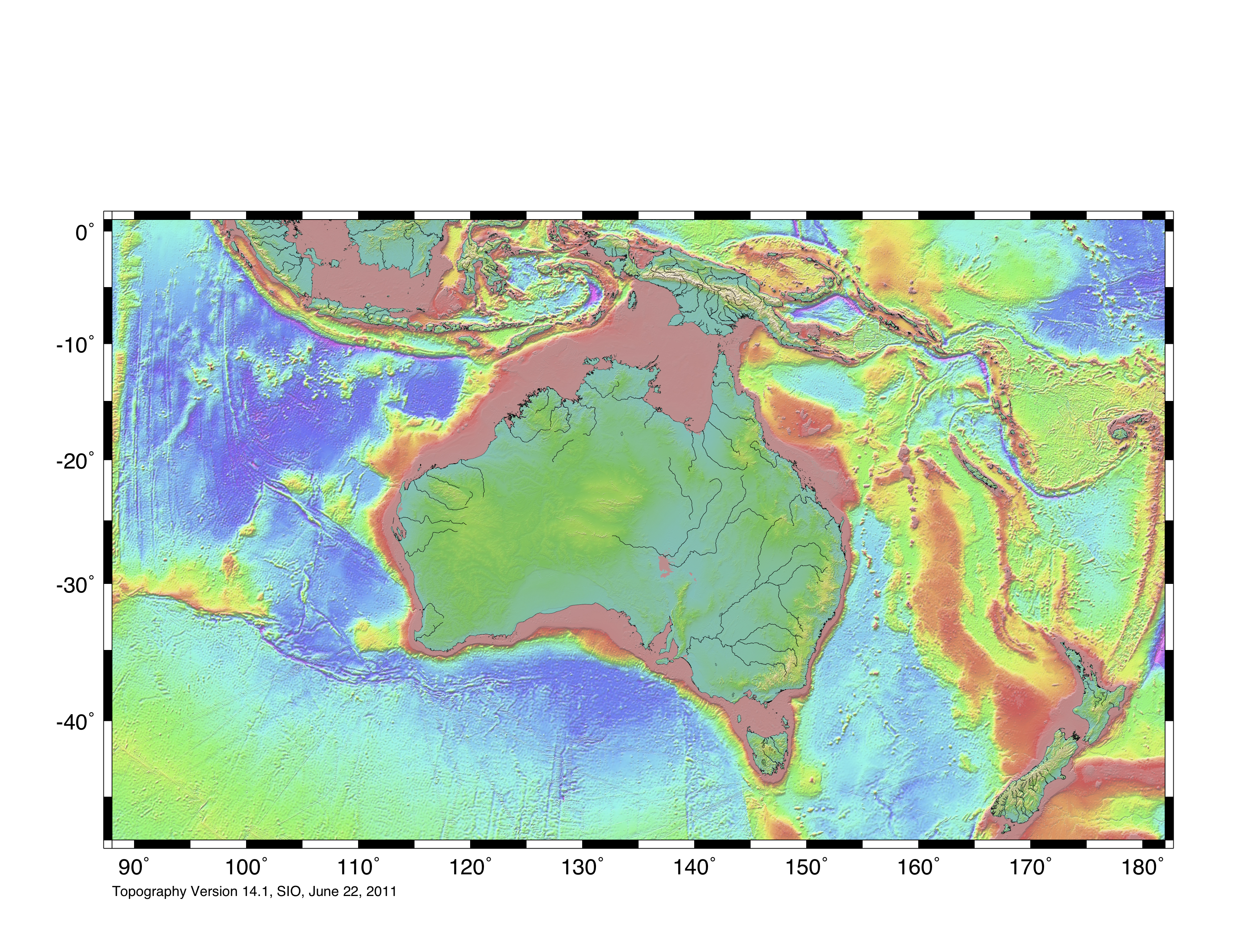
English: Topographic map of Coral Sea region, based on bathmetry data from Scripps Institution of Oceanography, University of California, San Diego.
Boundary is based on information which was given in: Nick Mortimer; Hamish Campbell (2014年) Zealandia - Our Continent Revealed、ロンドン: Penguin Books、p. 54 ISBN: 978-0-143-57156-8. . This file may be used with Template:Annotated image on Wikipedia which has advantages potentially over a labelled modified image, such as for other language wikipedias. |
| 日付 | |
| 原典 | https://topex.ucsd.edu/WWW_html/mar_topo.html; https://topex.ucsd.edu/marine_topo/jpg_images/topo10.jpg |
| 作者 | ChaseKiwi |
| 許可 (ファイルの再利用) |
There is no copyright on published bathmetry data, (free use) |
ライセンス
この作品の著作権者である私は、この作品を以下のライセンスで提供します。
| このファイルはクリエイティブ・コモンズ CC0 1.0 全世界 パブリック・ドメイン提供のもとで利用可能にされています。 | |
| ある作品に本コモンズ証を関連づけた者は、その作品について世界全地域において著作権法上認められる、その者が持つすべての権利(その作品に関する権利や隣接する権利を含む。)を、法令上認められる最大限の範囲で放棄して、パブリック・ドメインに提供しています。
この作品は、たとえ営利目的であっても、許可を得ずに複製、改変・翻案、配布、上演・演奏することが出来ます。 |
ファイルの履歴
過去の版のファイルを表示するには、その版の日時をクリックしてください。
| 日付と時刻 | サムネイル | 寸法 | 利用者 | コメント | |
|---|---|---|---|---|---|
| 現在の版 | 2023年8月5日 (土) 10:01 | | 1,253 × 776 (501キロバイト) | ChaseKiwi | Uploaded own work with UploadWizard |
ファイルの使用状況
以下のページがこのファイルを使用しています:
グローバルなファイル使用状況
以下に挙げる他のウィキがこの画像を使っています: